
Socastee Previous Residents by Era
A backward address search uses sources with very different coverage and limits. The current parcel record identifies the property and owner of record. Recorded deeds can connect transfers through party names and legal descriptions. Census, a directory book, or a newspaper notice may add a period-specific household layer, but none is a complete occupancy history. Horry County has not published the first online year for its land-record index or a verified Socastee directory run, so an honest trail names those limits and uses the counter or staff referral when the online record stops.
| Address-history source | Verified coverage | Where held | What it can establish |
|---|---|---|---|
| Horry parcel and GIS record | Current system; first online year not published | Authenticated County Land Records and GIS | Current tax parcel, owner context, PIN/TMS, and situs |
| Horry Acclaim deed index | Online; first online year not published | Acclaim and Register of Deeds counter | Grantor, grantee, book/page, and legal-description trail |
| Horry Probate files | Historic span not published | Probate Court forms and counter | Estate, will, representative, or marriage-license records as applicable |
| City or reverse directories | Not verified for Socastee | Thompson Heritage, HCML, or Historical Society | Possible period listing only after title and coverage are checked |
| Federal census | 1790-1950 releases | Library databases and National Archives resources | Household in its enumeration period, not a modern parcel record |
| Conway Sanborn | 1938 only located | Library of Congress | Conway comparison map, not Socastee coverage |
| Planning or plan file | No public historic online range found | Planning and Zoning counter or FOIA | Project, road, parcel, and applicant context, not a resident roll |
For a recent transfer, start with the parcel and deed chain. For a family question, add a released census or verified library source at the matching time. For a gap, ask the Register of Deeds about earlier books and ask Thompson Heritage or HCML staff to identify a real title before treating it as a Socastee directory. Note: The absence of a published coverage year should be preserved in the source log instead of estimated.
Start Socastee Previous Residents with a Parcel
Horry County's Assessor directs people to Land Records to find a PIN by address or owner name. For an address history, copy the County's full situs address, PIN/TMS, subdivision and lot or block if supplied, legal description, owner spelling, and any current mailing address. The situs is the physical parcel location. A mailing address is where tax correspondence goes and may belong to a post office box, representative, trust, or owner elsewhere. The legal description is the recorded land language that can remain useful when street wording changes.
As of March 16, 2026, the County requires a free user account for GIS, Land Records, and Tax and Assessor platforms that display property-address information. The account screen is a first step, not a public result card. The Assessor confirms address and owner-name routes to a PIN; earlier Horry flood-GIS instructions also identify TMS, PIN, owner, and address as property search keys. Use the Assessor counter at 843-915-5040 if the online path fails.
| TMS or PIN | County parcel identifiers that should stay with every deed and map note. |
|---|---|
| Owner | Owner of record, not necessarily a current resident. |
| Address | The situs or physical parcel address; access to displayed address data now requires a free account. |
| Map layers | Tax-parcel context and enabled layers after access. Horry says its parcel fabric is for taxing purposes, not a survey. |
The County's access-change notice explains the free-login requirement, and the Assessor page confirms the address and owner route to Land Records. Save the identifier first, because it is more stable than a postal label alone.
Socastee Deed Records Backward
The Horry County Register of Deeds preserves deeds, mortgages, plats, and other recorded land instruments. Its Acclaim official-records landing page provides Name, Book/Page, New Legal Description, Legal Description/Memo, Document Type, Consideration, and Record Date modes. Name means a grantor and or grantee search. The landing page advises trying spelling variants, and the online first-year coverage is not published. A missing online hit therefore does not close the trail.
- Use the current parcel record to preserve the owner spelling, PIN/TMS, legal description, and current situs address.
- Search the current owner as grantee in Acclaim, then identify the acquisition deed or available book/page reference.
- Copy the grantor, record date, document citation, and legal description, then compare the legal description with the parcel.
- Search that seller as grantee to locate the seller's earlier acquisition and repeat the comparison at every transfer.
- When the online chain stops, contact the Register of Deeds at 843-915-5430 or visit its counter with the legal description or book/page to ask about earlier books or microfilm.
- Grantor
- The party transferring an interest in a recorded document. In a purchase deed, this is commonly the seller.
- Grantee
- The party receiving an interest. Searching a former owner as grantee can reveal that person's acquisition.
- Chain of title
- A sequence of transfers for the same parcel, tested by legal description, lot, block, subdivision, PIN/TMS, or plat rather than a house number alone.
Acclaim's redaction bars can be temporarily removed after purchase for 24 hours and then return. Record citations while they are visible. The Register of Deeds counter at 1301 Second Avenue in Conway is the documented fallback for older records and copy questions. Note: A deed establishes a recorded property transaction, not who occupied the address on every day between transfers.
Socastee Legal Records Keep Continuity
A street address by itself can mislead a past-resident search. The same number can be re-used, a road name can appear in a different form, and one person can own several parcels. Carry the lot, block, subdivision, metes-and-bounds description, plat reference, or PIN/TMS from one deed to the next. A plat can connect a modern address to a lot and subdivision. Metes and bounds describes a parcel by courses and distances, so its recorded language should remain with the chain.
Acclaim's Book/Page and legal-description modes are useful when a party name changes form. The Horry GIS application can provide parcel context and layers, but Horry says its data are for tax purposes and not a boundary survey. A recorded plat, survey, or professional is the correct final source for a boundary conclusion. This distinction prevents a similar address or map point from moving the history to the wrong Socastee parcel.
Socastee Census Records for Households
Ownership is only one layer of who lived here before. The federal census is released on a 72-year schedule, with 1950 currently the newest public decennial census. It records a household in an enumeration period, not a modern ZIP or parcel system. Translate the printed address, possible road form, and community name before comparing it with a property record. Historic American Newspapers, cemetery material, and a dated obituary can help test a change between census years.
- Confirm the parcel and transfer period with the legal description, not an address alone.
- Ask HCML, Thompson Heritage, or the Historical Society whether a dated directory or reverse listing actually covers the address.
- Copy the directory title, publisher, page, year, and the entry exactly if an actual volume is located.
- Compare the closest released census with its enumeration geography, spelling variants, and family relationships.
- Use a dated newspaper, cemetery source, or Probate Court record to test a move, death, or succession rather than guessing from a missing name.
The historical collection questions are detailed on the Socastee city directory page. No verified standalone Socastee directory run, reverse-directory run, or house-history collection was located, so staff confirmation remains part of the process.
Lawful personal use. Address history can support family history, estate research, and property curiosity. Respect protected addresses and private information, and never use a record trail to stalk, harass, or harm a person.
Socastee Probate Records for Heirs
When a deed chain reaches an owner who died, separate sources can close the transition. Public-period death information, an obituary or newspaper notice, and a Horry Probate estate file may identify a personal representative or show that an estate was opened. Horry Probate Court has original jurisdiction over estates, wills, guardianship and conservatorship matters, trusts, and marriage licenses. It offers an Estate-only Records Request through its forms page and requires appointments to open an estate in person.
The Horry Probate forms page provides the official route for its Estate-only Records Request and related estate materials.
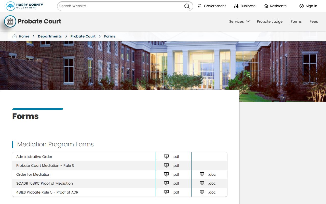
Call Probate at 843-915-5370 for the court's current record and copy procedure. An estate record is a distinct court source, so it should be cited independently from the deed chain and not used to guess a private current address.
Socastee Address Records and Postal Labels
Socastee's address-continuity trap is often the postal city, not a verified communitywide street renumbering. A physical Socastee address in ZIP 29588 can appear with Myrtle Beach, SC 29588 as its postal wording in county material. Socastee is a CDP rather than an incorporated city boundary. Keep the road name, PIN/TMS, legal description, and coordinates where available, and do not treat a Myrtle Beach mailing label as proof that the parcel is outside Socastee.
Horry County found no official source for a Socastee-wide renumbering or renaming year. For a changed historical address, bring the current PIN/TMS and old deed or directory citation to County Addressing and E911 instead of assigning an unverified change date. This geography check is useful whenever a directory, census page, tax record, and deed use different place names for what may be the same parcel.
Socastee Parcel Records and Plans
Planning and Zoning material can add structure or development context after the parcel is identified. Horry's site-plan checklist ties project material to an owner of record, owner address, developer, PIN or TMS, zoning or overlay, acreage, existing and proposed road names, and whether a road is public or private. A registered user submits a project through the County route, and review comments are uploaded to that account. No public ordinary-person permit or code-enforcement result page was verified for Socastee.
For a specific file, use the PIN, address, road name, and defined date range at the Planning and Zoning counter or in a narrow County FOIA request. Horry County's Address Request Form also explains that structure addresses are assigned through county administration, not proof of occupants. The form's published review period is 3 to 5 business days. Note: Plan documents can date a project or connect it to a parcel, but they are not a full household record.